Publications
 Partners


Johannesburg - Indoor areas of selected airports, shopping centres, casinos, convention halls and universities in South Africa are now mapped by search giant Google’s mapping service.
Google Maps in South Africa previously allowed users to view digital maps of outside areas, such as streets in cities like Johannesburg and Cape Town.
But the search giant is taking this capability indoors as it seeks to help web users find their way inside certain locations.
This means users can access Google Maps features such as ‘Where am I’ and ‘What’s around me’ when traversing a selection of indoor environments in the country (click here to view the full list of SA indoor areas covered by Google).
“Google Maps already allows you to plan a route, get directions and explore many neighbourhoods with street-level imagery, while the ‘My location’ feature can show you where you are on a map to stop you getting lost,” Google said in a press statement on Wednesday.
“Today, we’re taking Google Maps in South Africa to another level: we’re delighted to announce that we’re now able to show indoor maps for a number of locations,” added the search giant.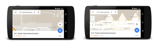
The inside of Johannesburg's O.R. Tambo International Airport is mapped by Google on the right. (Google)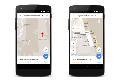
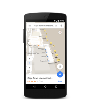
The indoor area of Cape Town International Airport is now also mapped by Google. (Google)
Google said it has initially partnered with over 30 organisations such as the Airports Company of South Africa (ACSA), Gauteng’s high-speed rail link Gautrain and hotel group Tsogo.
More indoor areas are planned to be mapped by Google.